


Petroglyph National Monument

A Place of Cultural Expression and Geological Wonders
June of 2024 marks the 34th anniversary of the establishment of Petroglyph National Monument, a park of enormous cultural significance located just outside of Albuquerque, New Mexico. These lands are sacred to many Indigenous peoples including the Pueblos of Acoma,Cochiti,Isleta, Jemez,Laguna, Nambe, Ohkay Owingeh, Picuris, Pojoaque,Sandia,San Felipe, San Ildefonso,Santa Ana, Santa Clara,Santo Domingo (Kewa), Taos, Tesuque, Zuni, and Zia, as well as the Fort Sill Apache, Jicarilla Apache, Mescalero Apache, andNavajo Nation, which includes the To’Haijilee, a non-contiguous section of the Navajo Nation. The monument preserves thousands of petroglyphs. While the majority of these petroglyphs are thought to be carved by the ancestral Puebloans, some petroglyphs are thought to have been carved by other Indigenous peoples and by Spanish colonizers. As you plan your trip, visit New Mexico True, Visit Albuquerque, the National Park Service for helpful tips and updates.
A Place of Change: How an Ancient Landscape Adapted to the Modern World
by Rachel Taylor, Park Ranger, Petroglyph National Monument
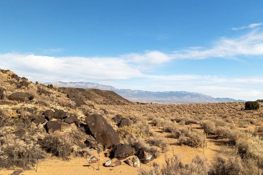
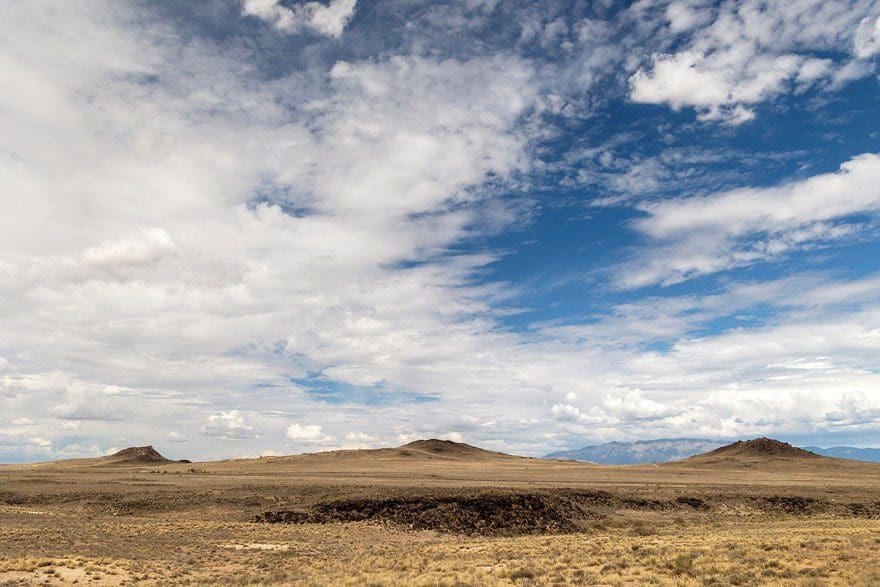
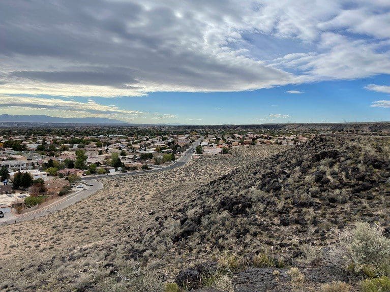
Petroglyph National Monument sits on the western edge of what is now called Albuquerque, New Mexico—the largest metropolis in the state. The monument’s 17-mile volcanic escarpment is humble in appearance relative to the impressive Sandia Mountains on the eastern edge of the city. Both geologic features are parts of an ancient landscape that has influenced the culture of an entire region.
Why Here?
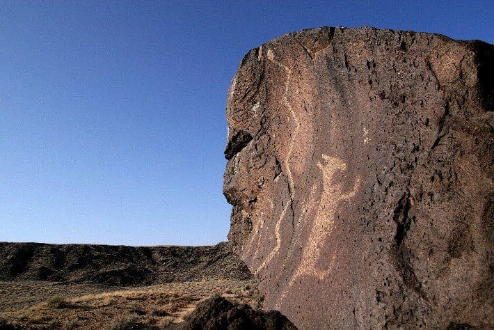
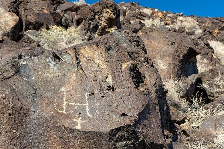
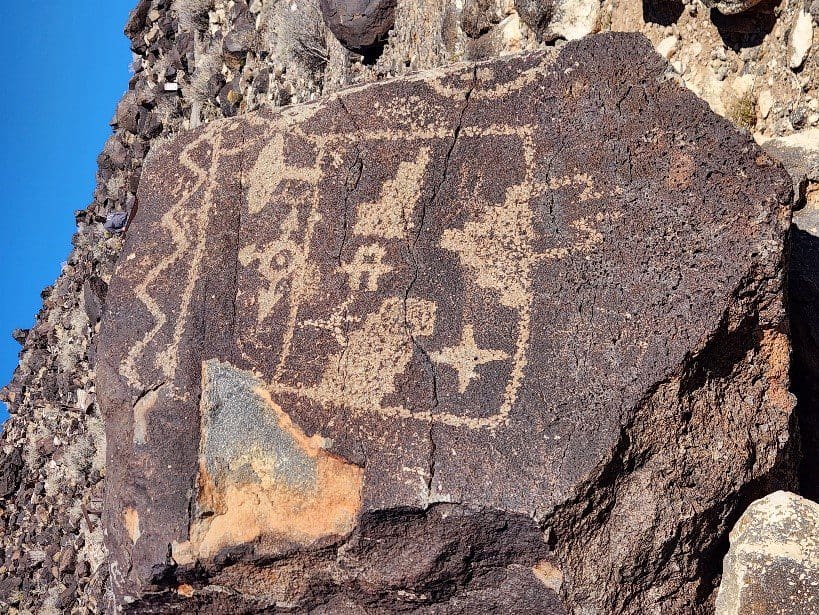
The volcanoes were and continue to be sacred symbols in the Puebloan worldview. The direct connection to the Earth is what drew many ancestral Puebloans to travel through the area and carve the sacred petroglyphs. Most of the 20,000 petroglyphs in the monument are estimated to have been carved 400-700 years ago, at the height of ancestral Puebloan culture in the region. The basalt boulders are covered with a desert varnish or patina that gives the rocks a dark look. When this varnish is scraped away with stone tools, the true, lighter color of the basalt is exposed. This contrast is what made these basalt boulders the perfect canvas for communicating important messages between groups of people.
Want to help preserve these significant lands for generations? Your donation supports kids’ programs, research, Indigenous artists’ demonstrations, and more!
Understanding the Volcanic Landscape
Roughly 30 million years ago, the earth’s crust began stretching apart in an east-west direction. This action caused the Sandia Mountains to rise above the sinking basin, now called the Rio Grande Rift Valley. The slow movement set off chain reactions that resulted in the Albuquerque volcanoes much later. Between 155,000 and 200,000 years ago, a crack formed in the earth’s surface, allowing hot, liquid magma to shoot up and ooze eastward across the landscape at about 5-10 mph. These fissure eruptions occurred six times. At the end of the last eruption, six cinder cones were formed due to a buildup of ash, cinder, and cooling lava rock. The result was a series of six volcanoes and a caprock of basalt, 17 miles long and 12 miles across. The heavy basalt eventually crumbled and fell apart, leaving the boulders that we see today.
Additional History
When the Spanish arrived in 1540 and began settling the area around 1600, ancestral Puebloan life changed dramatically. Under Spanish rule, the numerous Pueblos along the Rio Grande began to suffer from illness and disease. After extensive and secret communications with each other, the Pueblos successfully rose up against the Spanish in the Pueblo Revolt of 1680. In 1692, the Spanish returned. The area changed again. The sweeping grasslands across the volcanic mesa gave way to rudimentary cattle and sheep ranches. The reality of private land ownership became more and more prevalent with new land grants given to Spanish colonists by the King of Spain.
Protection of a Sacred Place
Over the next few hundred years, the Villa de Albuquerque grew into the modern city we know today. As urban development began expanding westward in the 1970s, the sacred lands of the petroglyphs became threatened. The desecration and destruction that this area faced inspired local citizens, Tribal elders, and scientists to advocate for the protection of these irreplaceable resources. Their hard work finally paid off on June 27, 1990, when Petroglyph National Monument was established by an act of Congress.
Planning for the Future
The area surrounding Petroglyph National Monument continues to change. Urban expansion is one of many challenges the park faces while upholding its mission to protect and preserve the natural and cultural resources of this amazing landscape. Despite so many changes throughout history, the petroglyphs, the volcanoes, and the lands surrounding them have endured.
All of the staff at Petroglyph National Monument work to educate and inspire visitors and neighbors of all ages and backgrounds. They encourage land stewardship and a love of the natural and cultural environment for future generations. Petroglyph National Monument will continue to experience change as time goes on; our job is to make sure the change is in a positive direction.
Want to show your love and support for these incredible lands?
Shop WNPA’s collection of apparel, books, collectibles, and more!
