


What Fueled Sunset Crater’s Explosive Past?
“Long time ago the ground trembled, a big black smoke came,” was the memory the Hopi passed from generation to generation. It was a thick, choking, even poisonous smoke, preceded no doubt by shuddering earthquakes and precipitated by a furious, explosive eruption that alternately darkened and lit up the sky for hundreds of miles around.
Where only fields of maize and surrounding pithouses on the edge of a pine forest had stood, there suddenly was a growing, fuming, and sputtering cinder cone in a landscape dotted by hundreds of much older cinder cones that stood in silence. Palatsmo was not silent, and it tore at the land.
“The whole thing opened up in this massive rift that was about 10 kilometers long. And at the far end of that rift was a lava flow,” Amanda Clarke says in picturing how the eruption must have appeared to those 11th century farmers. “There was a lava flow out in the woods at the end of this rift, and that would have been something that would have been a relatively gentle eruption.
“They would have probably been experiencing earthquakes,” she continues. “I would think there would have been fractures and gas releases along the length of that fissure. And then the first really scary phase of the eruption would have been an eruption along the length of that fissure with a seven-or-so-kilometer-high plume (combined with a lava fountain possibly 2,000 feet high). That would have been really spectacular.”
Clarke had come to understand the birth of Palatsmo, the Hopi word for today’s Sunset Crater, in a bid to explain how this cinder cone volcano had managed to deposit its tephra across an area possibly 19 miles (30 kilometers) wide in today’s northern Arizona.
The volcano, a dozen miles north of Flagstaff, is one of an estimated 600 cinder cone volcanoes once powered by a maze of magma plumbing flowing out from the San Francisco Peaks, which are the remnants of a stratovolcano. Sunset Crater is the youngest of the volcanoes in the 1,800-square-mile San Francisco Volcanic Field.
What Clarke, an associate professor at Arizona State University whose research focuses on the physics of volcanic eruptions, and her team concluded was that the eruption that occurred around 1085 AD was most definitely atypical for a basaltic volcano.
“It was an unusually large basaltic eruption. If you’re in one of these volcanic fields that’s full of cinder cones, the expectation is that those eruptions are going to be smallish, just big enough to form the cinder cone,” she explains. “Theoretically, someone could sit a mile away and watch it and be entertained and not be in danger.
“But this particular eruption was rather large. The footprint of the cinders and ash that fell is at least 25-30 kilometers in diameter,” Clarke continues. “The eruption took place while there was a population living in that area, farming in that area. The ancestors of the Hopi people. And they were displaced because of this large eruption, into the Wupatki area.”
Paul Whitefield, a natural resource specialist with the National Park Service, says the Sinagua culture in the area had ample warning to flee.
“There would have been days or months of some seismic tremors before there was any kind of evidence of molten rock, and there would have been a lot of hydrogen sulfide gas venting and roaring. So there would have been a number of other sensory experiences before a volcano would have started building or even lava started flowing,” Whitefield explains during a phone call. “But they would have been alerted and they had time to actually round up their possessions and evacuate. It wasn’t a Pompeii-style event.”
It’s not difficult to accept that the life-changing eruption would hold prominence in cultural lure. Imagine living today on the Island of Hawai’i and witnessing the months-long eruption of Kīlauea at Hawai’i Volcanoes National Park during 2018. The lava fountains that flared into the sky night and day, and the seething lava flows that incinerated everything in their path would be cemented into your memory and surely handed down when you were asked where you were and what you saw during those eruptions.
That’s how it was with the Hopi and their Sinagua ancestors who occupied the land today preserved within Sunset Crater Volcano National Monument not far from present-day Flagstaff. Elizabeth Brandt was able to capture a bit of the setting in 1997 when she wrote the Anthropological Literature Review and Annotated Bibliography for Sunset Crater Volcano and Wupatki National Monuments:
… flames and the glow of hot lava issuing forth from such beds continued to confirm early Hopi legends that this land belonged to their Fire God, Masauu, who was also the god of the surface of the earth, from whom they inherited the land and with whom they have a covenant to care for it.
A 2008 paper examining Variable Effects Of Cinder-Cone Eruptions On Prehistoric Agrarian Human Populations In The American Southwest noted Hopi stories that attributed the eruption to tribal members straying from a virtuous life.
“Many eruptions are seen as signs of spiritual and moral transgressions and offerings are made in an attempt to rectify these ‘sins’ and avert the ongoing destruction,” wrote the authors. “Hopi Indian accounts of the Sunset Crater eruption, for example, cite various offenses, including gambling, immoral behavior, and the cuckolding of a powerful supernatural being.”
A section of Chapter 7 in Sunset Crater Archaeology: The History of a Volcanic Landscape, a collaborative effort that Mark Elson edited in 2011, notes that “(T)oday, the volcanic landscape created by the eruption of Palatsmo is considered a sacred landscape, serving as an admonition for the Hopi to remain committed to their religious ideals of community life and serving as humble stewards of the land.”
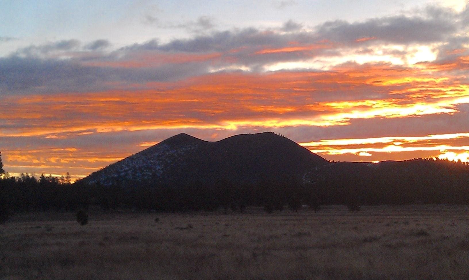
Sunrise at Sunset Crater, which was given its name for the colorful cinders that seem to glow under the sun (NPS)
Sunset Crater Volcano National Monument was established after a movie company wanting to film an actual landslide asked if they could blow up Sunset Crater. The public moved to protect the volcano, leading President Herbert Hoover to establish Sunset Crater National Monument on May 26, 1930. “Volcano” was added to the park name in 1990. Learn more about this park in the book Sunset Crater Volcano National Monument or bring home an official park product from Western National Parks Association.
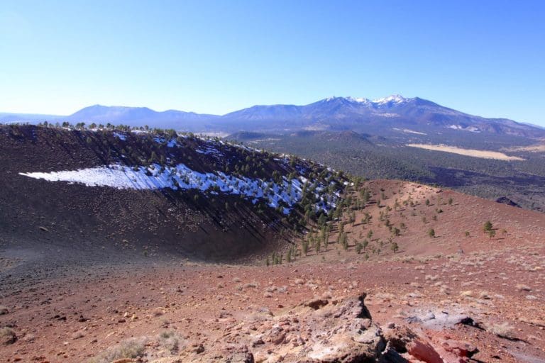
The interior of Sunset Crater, with the San Francisco Range in the distance (NPS, C. Schelz)
Clarke’s investigation into the eruption paints it as “the most explosive cinder cone eruption yet documented.”
“It had at least five explosive bursts, and those bursts produced plumes that” ranged in height from 4 miles (7 kilometers) to perhaps as high as 19 miles (30 kilometers) over the landscape. “These plumes would have been visible all over the Southwestern region,” she says. “All over Arizona, northern New Mexico, various places. They were these really tall plumes that produced this blanket of ash and cinders.”
Driving the sheer force of those eruptions, it appears, were bubbles of carbon dioxide within the magma chamber some 9 miles underground. Coming to that conclusion was not easy. It involved collecting tiny olivine crystals from the tephra layer beyond the national monument’s borders, and then analyzing their chemical composition.
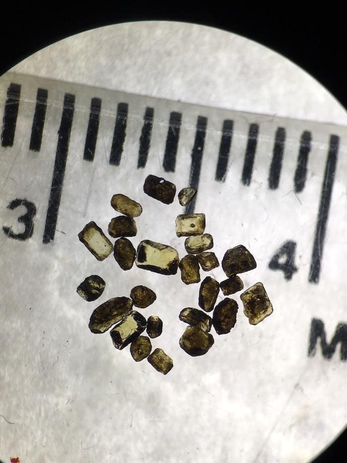
These olivine crystals held some of the secrets of Sunset Crater’s explosive eruption (Chelsea Allison)
As the crystals grew within the magma they captured “pockets of melt,” as Clarke describes it. During the eruptions, as these crystals were flung out of the cinder cone, they quickly solidified, locking that melted material within.
Chelsea Allison, then a graduate student working with Clarke and Kurt Roggensack, a global expert on analyzing these crystals, was able to decipher the chemical makeup of that material.
“We found some surprising things. Some of that was that there was a huge amount of carbon dioxide in this melt,” says Clarke. “We thought maybe there would be a lot of carbon dioxide, but it turns out there’s quite a lot compared to what we can demonstrate for most magmas.”
Also contained within the crystals when they were created was water and sulfur dioxide. But it seems it was the carbon dioxide that was the key driver of Sunset Crater’s eruption. Think of a bottle of soda. Sitting on the table, the carbon dioxide isn’t clearly visible. But shake up that bottle….
“Think about this body of magma sitting 15 kilometers deep with little bubbles already in it. It’s sort of like Coca-Cola sitting at 15 kilometers depth,” said Clarke. “We’re pretty sure, with a fair amount of certainty, that this magma was sitting down there at great depths already in a bubbly state.”
When the eruption began, the carbon dioxide contributed great force to it, just as the carbon dioxide in your bottle of soda does when you shake it up and pop the lid. The more difficult question to answer with Sunset Crater, said the professsor, is why was there so much carbon dioxide present in a system in the first place.
Sunset Crater’s eruption drove the surrounding cultures north to present-day Wupatki National Monument (NPS file)

“We think that that is some part of the story. There is this question: How under what circumstances, does a basalt that typically just produces gentle lava flows, or often produces gentle lava flows, under what conditions and why does it produce a big eruption plume?” she says. “Some people have said that it has something to do with the viscosity of the magma and some processes that make it less liquid-y than we expect it to be.
“But it’s always been a question. Gases in the magma are generally what controls the size of an eruption. So probaby it’s worth pursing that story. And that’s why we started Chelsea down this line of looking at these little pockets of melt and measuring the amount of gas that was in there,” Clarke tells me. “The amount of carbon dioxide is really, really high, and the fact that some of it was in the bubble form already makes us think that that’s not a coincidence, that that has something to do with the explosivity, the intensity of the eruption, how high it produced these plumes.”
While Palatsmo’s eruption forced out a population of perhaps 2,000 that had farmed the surrounding area, it also helped create a somewhat welcoming area for them to head to. The location is protected today as Wupatki National Monument to the north of Sunset Crater. Before the eruption, the landscape around Wupatki was arid and poor for agriculture. But the ashfall that reached the area during the eruptions changed that.
Those who witnessed Sunset Crater’s eruption are thought to have pushed corn cobs into the soft lava to create impressions. To the Hopi, this “corn rock” signifies “our ancestors were here.” (USGS)
“During almost its entire history, this area was avoided by inhabitants of the surrounding regions; Wupatki is arid, wind-swept and inhospitable,” Dana Hartman and Arthur H. Wolf wrote in the archaeological assessment of the area they did for the National Park Service in 1977. “For a time lasting less than 150 years, however, Wupatki flourished as a cultural contact zone. This population influx was due to the effects of the A.D. 1064-1065 Sunset Crater eruption, which spread a moisture-retaining layer of volcanic ash and cinder over the landscape and permitted agriculture in the previously unfertile area.”
Since that paper, other archaeologists have come to the same conclusion, that the eruption in effect put down a layer of “volcanic mulch” that helped the soils below retain moisture.
Whitefield says the ashfall that reached the Wupatki area fell in just “the right thinness” to provide benefits.
“It was probably 1-3 inches of a very fine glassy ash. It was just perfect to actually retain precipitation on the average annual precipitation they get,” he said. “It prevents the soil from drying out.”

Even today, more than 900 years later, the soil benefits around Wupatki remain, said the Park Service specialist.
“Without the ashfall it would look a lot more of what you see north of Wupatki, where there’s no ash,” Whitefield said. “A much more sparse, barren desert shrub red-rock type of desert. There’s still enough ash still drifting around, several inches deep at just the right depth.”
Looking ahead, Clarke sees the need for more research in the San Francisco Volcanic Field. In particular, she wonders whether Sunset Crater was the only cinder cone volcano in the field to have such an explosive creation?
“Almost all of the volcanoes in the field are cinder cones. But we don’t know how common it is to have these cinder cones produce these pretty big explosive eruptions,” she said.
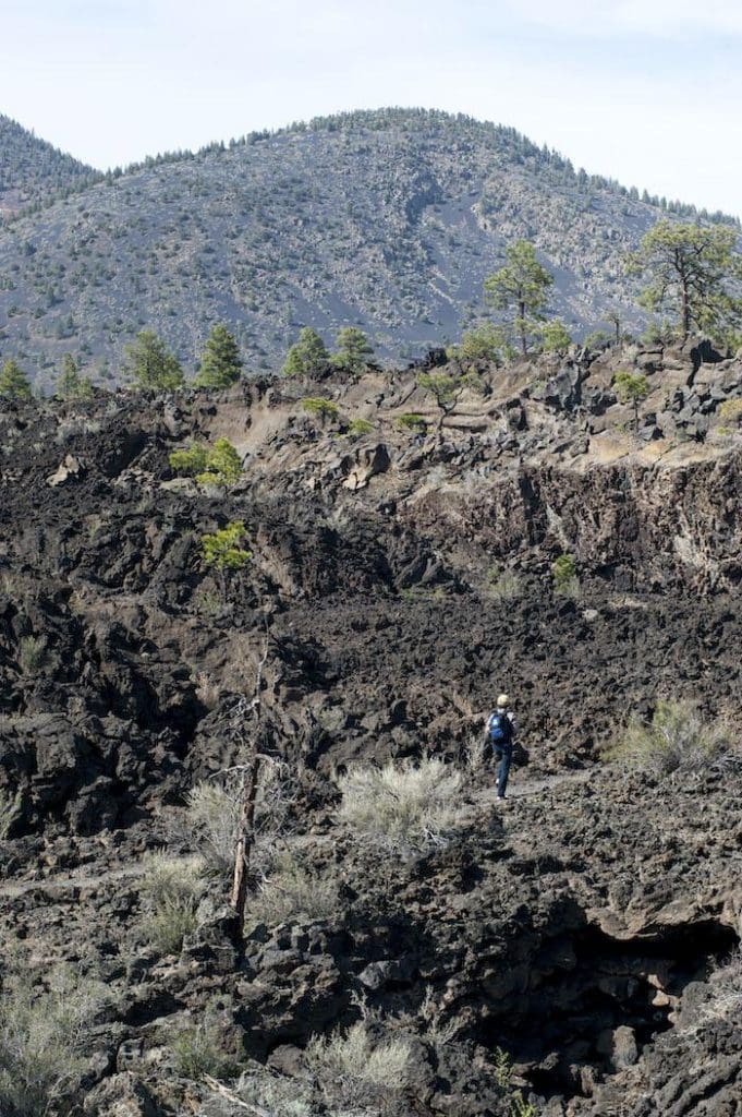
Traveler footnote: Today you can explore the lava beds around Sunset Crater and the monument’s other cinder cone volcano, Lenox Crater. During the summer season rangers often lead hikes on the Lava Flow Trail; check with the park to see if the hikes are being held. The park also has been certified as an International Dark Sky Park, making it a great destination for staring into space.
Support from Western National Parks Association made this article possible.
